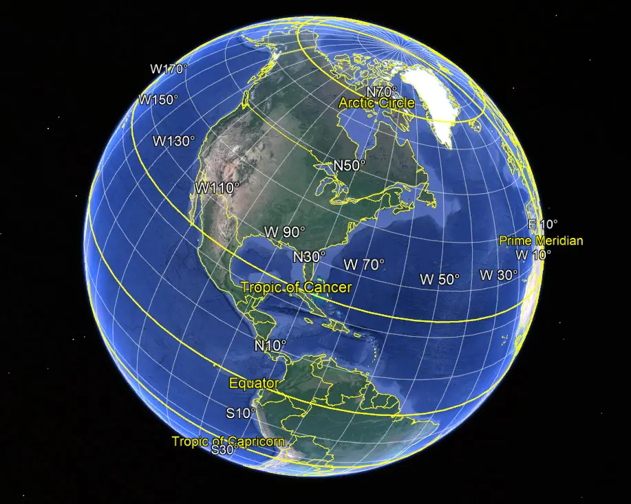
Generic selectors
Exact matches only
Search in title
Search in content
Post Type Selectors
Search in posts
Search in pages
Search in posts
Search in pages
Railroad 360 video Imaging and mapping is a technique which reproduces 360 videos and panoramic pictures of the right of way and tracks. 3D as-built.

Railroad 360 Video

Every railroad corridor requires a set of fiber optics cable network in order to keep it running but what does railroad 360 video mapping have to do with this? Like any other construction project, installation of a fiber optics cable...

railroad panoramic imaging uses 360 degree camera with GPS and sometimes LiDAR to perform track surveys and condition assessment. Relaity IMT generates 3d..

Railroad Panoramic Imaging

Street view Imaging for railroads streamlines planning & Inspections Every railroad corridor requires a set of fiber optics cable network in order to keep it running. Like any other construction project, installation of a fiber optics cable network requires a...

Drone Mapping Technology- 5 things to evaluating an effective drone mapping project. from hadrware, software to data delivery. Reality IMT Houston, Texas

Aerial Mapping Using Drones

Here is a Quick Guide to selecting the right drone for your aerial mapping projects How often have we wanted to get a bird’s eye view with location intelligence from a certain height? Drones give you the chance to view...