Drone Data Management Software Might Help!
There was a time when the usage of drones was only limited to the military. However, the usage and applications of commercial drones are on the rise today and drones industry is growing faster than ever. This article will be focused on drone data management software, and how choosing the right solution can help increase efficiency by two folds.
A recent report from Business Insider, has revealed that drone applications are expanding and growing faster as the cost is going down, and the technology is progressing further. The usage of drones, per the report, is expected to expand mostly in the commercial and civilian sectors. However, other sectors like infrastructure, mining, inspections, energy and the like are also going to witness tremendous growth.
It is imperative that as drones are finding widespread uses throughout, businesses that fail to harness the best from them, will find it difficult to keep up with the growing competition. The key may lie not in the hardware used, rather in the drone data management software that can archive all the captured data, and help streamline the inspection process.
How Do I Manage my Drone Data?
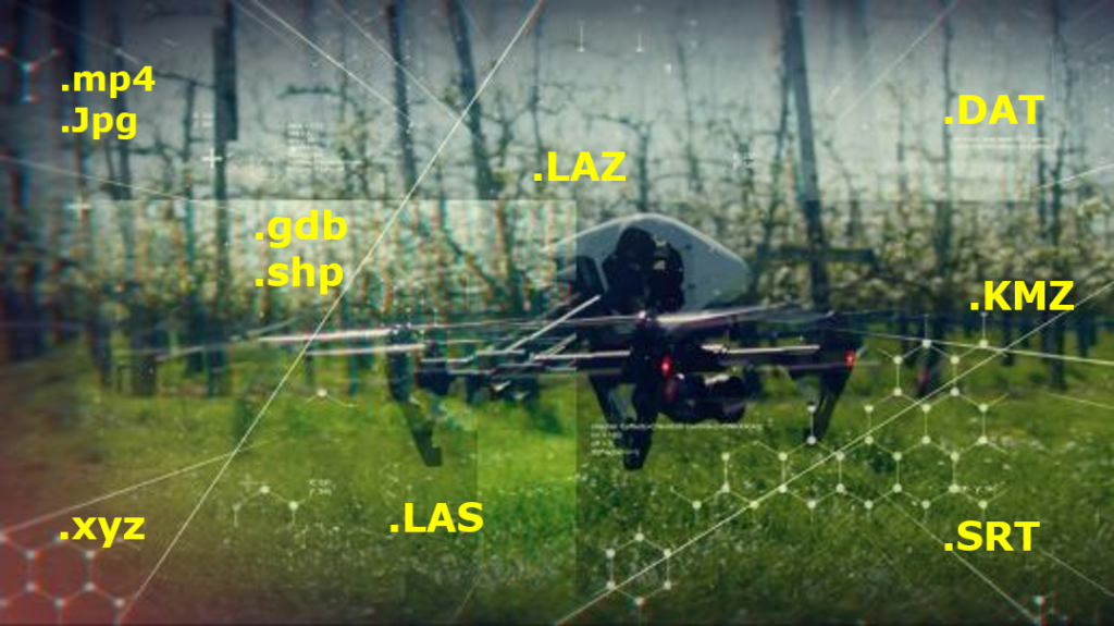
Once you have decided to use a commercial drone for your business as an aerial data-collection robot, the big question here is – how do you plan to handle the collected data? Drone data comes in many different formats including geo images, video files, and LiDAR surveys?
Further, since this collected data might need to be viewed across the organization for deeper insights and collaboration, how are you going to manage the process in the most efficient way possible?
This is where drone data management software can make your tasks easier. you should be looking for a solutions that is user friendly, and does not require experts to operate. Web-based software is the best way to share information across team members. It also enables you to access the data from any location.
Geovideos, GeoImages, GPS Data, GIS, Where Does It All Go?
When evaluating the benefits of applying aerial video and aerial imaging technology in your day to day operations, it is crucial to have a plan covering how you will manage and view the data. Starting out with the end goal in mind, and working your way back through the process helps think about all the steps involved along the way. The focus should be on developing a robust UAV data management plan. A good place to start would be putting together a list of requirements to cover how the viewer will interact with the information, and what the expected final deliverable will look like. Diagram below shows 4 steps to consider when developing a UAV data management plan.
UAV data management software are making it easier to control and execute complex aerial inspections. You can now easily have an aerial 360º video integrated with Geographic Information System (GIS) to enable geotagging points of interest. POIs are based on the given coordinates of the UAV. You can also load layers with certain attributes onto the basemap to help visualize all related project information.
Further, there are many tools that can automatically produce a 3D model from the data and imagery collected by drones. This can be of great use in the construction industry.
UAV data management software can even help you track inventory. As an example, Walmart visions to have drones enabled inventory by end-2017.
That said, having proper drone software is thus a necessity. But, is it wise to choose any random software that is readily available? Well, no.
Things to Keep In Mind While Choosing A Drone Data Management Software
Undoubtedly, there is an array of UAV platforms to choose from in the market, but there is a dearth of proper data management solutions which would benefit the end users. Particularly, when you are employing a UAV as an integral part of your business setup, it is important to have a well-laid out plan for managing and viewing the data based on the following:
- Note down the list of requirements
It is essential to understand your core requirements, and analyze the expectations from a data management solution. Note down how the viewer will interact with the information, as well as any expectations on the final expected deliverable.
- Data format
Once you have all the data in place, in which format would you like to receive it? Would you like it in the form of images or a 360-degree video, .laz format or .dat format?
- Frequency of collecting the data
How soon would you like the data to be collected and disseminated? Would you like to archive the data automatically after a fixed interval of time? Finding answers to all these questions is necessary for the proper execution of data management plan.
- Security
So, who all will be responsible for the processing of data? It is essential that you Ensure the security and integrity of the data.
The bottom line here is that a proper UAV data management plan should be versatile, adaptable, clear, organized and scale-able.
Is Your Business Ready To Take The Plunge on UAV Data Management Software?
Needless to say, proper Drone data management software is the need of the hour if you simply would not like to lose to your competitors. From tagging images properly to storing and retrieving them later – does your organization have the right set of tools and equipment to take care of large chunks of data?
You might already be handling data and might have your own set of data management rules, but the data captured by drones is an all-new territory and has its own pitfalls and opportunities.
Do you have the required solutions to make the best out of drones in addition to your regular business operations? If no, we might help! We power OcuMap which increases your efficiency by 50% and minimizes site visits by 80%. OcuMap is cloud-based geovideo software that helps you visualize the site from any location through aerial 360º video, geoimages and GIS allowing for a streamlined and archived remote inspection.
Curious? Talk with us today to discuss more!