gps mapping software

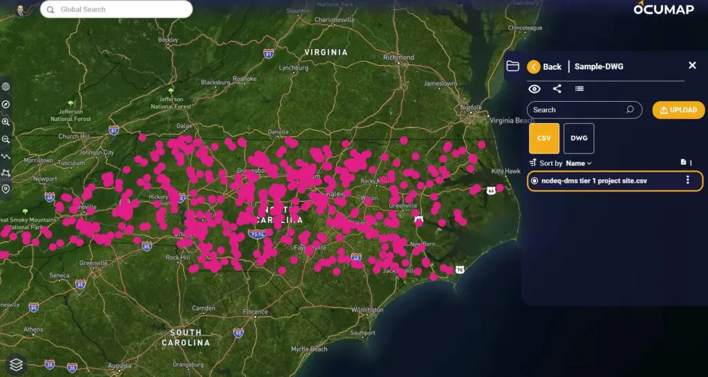
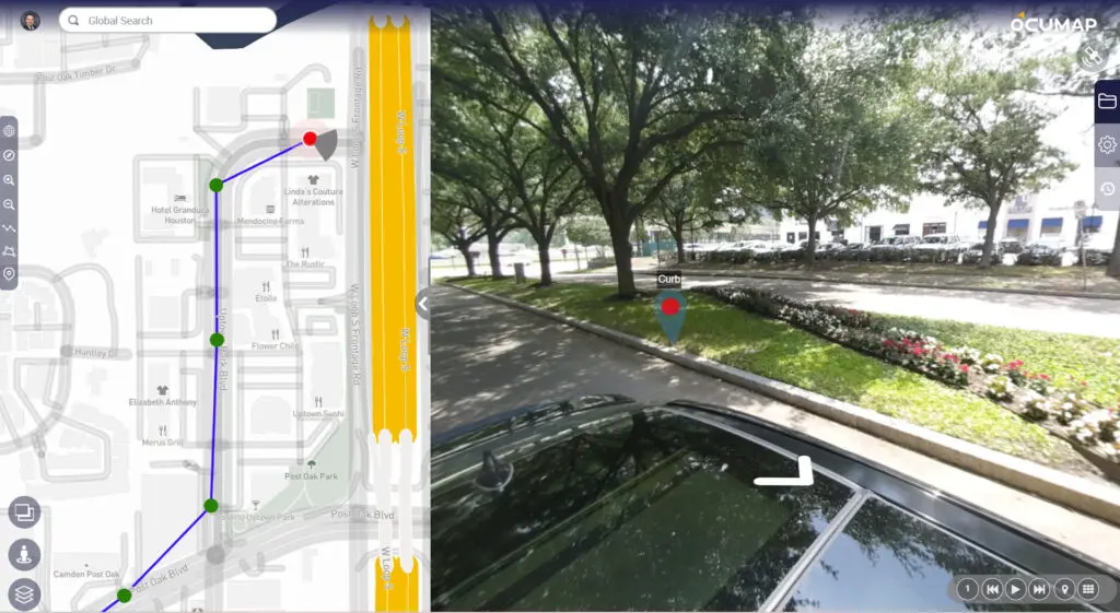
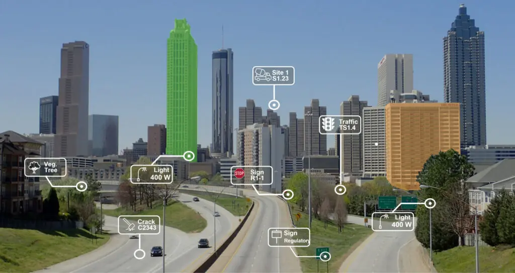
GPS Mapping Software: Revolutionizing Navigation and Data Analysis

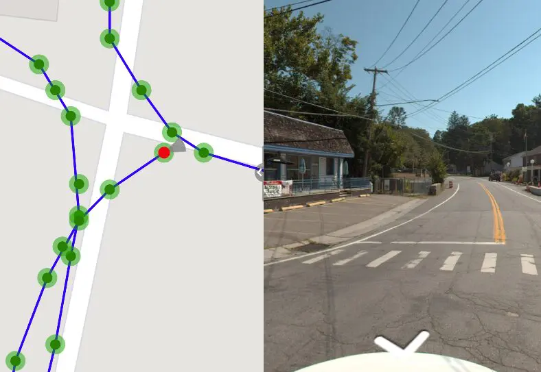
Today’s world demands efficiency and precision, and GPS mapping software has become a vital tool for data analysis and navigation. This technology has revolutionized the way we see and engage with the world, offering priceless information for a variety of...

environmental management

Interactive Mapping Software: A Comprehensive Guide

Interactive mapping software is a powerful tool that allows users to create, visualize, and analyze data on a map. It is used in a variety of industries, including business, government, and education. In this article, we will explore the best...

3D Mapping Software

3D Mapping Software/Solutions: A Detailed Guide

The digital world is becoming increasingly three-dimensional. From architectural design to urban planning, 3D mapping software is revolutionizing the way we capture, visualize, and analyze our physical environment. This comprehensive guide delves into the world of 3D mapping, exploring its...

Mobile Mapping GPS Camera Software-Geotagging-OcuMap

Best GPS Cameras for Mobile Mapping

Depending on the task at hand, you will find it difficult to choose the best GPS camera for your mobile mapping project. While there are many off the shelf GPS cameras available, you want to make sure you invest in...

3D Mapping for street level imagery

3D Mapping Software Overview: Simplifying Image-Based Mapping

Enter OcuMap 3D Mapping Softwares, a cutting-edge solution poised to revolutionize the art of image-based mapping. This software, a result of relentless innovation in the field, transcends traditional mapping boundaries to offer a sophisticated and user-friendly approach to mapping infrastructure...

EXIF data

What Does EXIF Data Mean In Mapping?

EXIF Data: How is it used in Mapping EXIF Data, which stands for “Exchangeable Image File Format,” is a set of standardized tags embedded within digital photos. It’s like a hidden document attached to each image, revealing valuable information about...

360 Video Mapping In OcuMap

What is 360 Video?

360 video, also known as Panoramic, Immersive or spherical Video is a term used to describe a hardware and software video technology that applies multiple camera sensors or lenses to record frames in all directions. These sensors are programmed or...

GPS cameras of 2020

Best GPS Cameras of 2020 Breakdown

Different circumstances call for different cameras. Having the right camera at the right time can take the final product from acceptable to truly impressive. Here is a guide to various camera types with the pros and cons of each and...

Street Level Mapping

Street Level Mapping With Spherical 360 GPS Camera

How to document assets within your city using an off-the-shelf GPS camera Street Asset Management is no longer restricted to highly-trained professionals, but to the masses: with a GPS camera, and OcuMap, you have everything you need to go out...

Map Projection

Map Projection Basics

Map Projection Basics Map projection is a crucial technique used for hundreds of years to ensure coordinates are projected accurately onto a flat map.  Watch this great video by Vox explaining why we use projections when dealing with geomatics and...