Depending on the task at hand, you will find it difficult to choose the best GPS camera for your mobile mapping project. While there are many off the shelf GPS cameras available, you want to make sure you invest in the right system. Our recommendation would be to follow these simple steps to determine which camera system will work best for your project.
Step 1. What is the expected final deliverable?
Are you expected to deliver GPS-photos, GPS video, Geotagged features in GIS or simply a spreadsheet with photos documenting the Points of Interest (POIs)?
Step 2. How large is your project?
You can measure the size of the geographic area by linear miles/km or by areas if you are mapping from the air.
Step 3 . How will you collect your data?
Do you plan to drive, walk or fly the area of interest. This will help you find the correct mounting mechanism for your GPS camera.
Step 4. Where will you store your data and how will you share it?
Different cameras produce different resolutions and therefore you can expect to have different size data depending on the GPS camera you choose.
Once you have determined the answers to the steps above, you can take a look at the following table to identify the GPS camera that will meet your requirements.
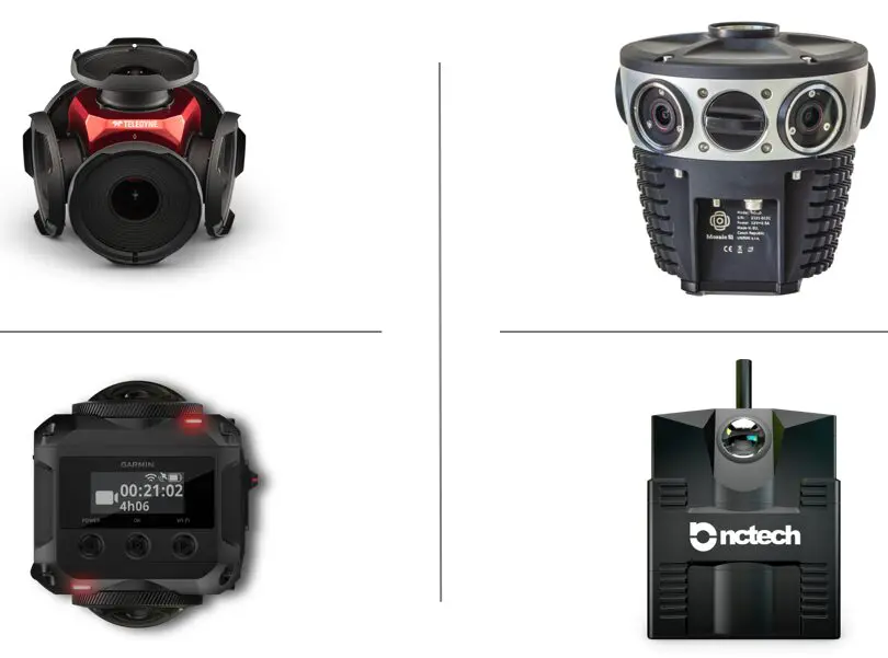
| Feature | Insta360 Pro 2 | FLIR Ladybug 5+ | Mosaic51 | Insta360 One X2 | NCtech Imaging iStar | VIRB 360 | GoPro MAX 360 |
|---|---|---|---|---|---|---|---|
| Resolution | 6K @ 30fps, 5.7K @ 24fps | 8K @ 30fps, 4K @ 60fps | 12K | 5.7K @ 30fps, 100fps in FlowState | 4K @ 30fps | 5.7K @ 30fps, 4K @ 60fps | 5.7K @ 30fps, 3K |
| Built-In GPS | Yes | No- External NMEA Signal | No- External NMEA Signal | Optional external module | Yes | Yes | Yes |
| Horizontal GPS Accuracy | 5-10 meters | 1 to 15 cm with RTK | 1 to 15 cm with RTK | N/A | 5-10 meters | 5-10 meters | 5-10 meters |
| Stitching & Georeferencing | JPEG EXIF VIDEO: N/A | JPEG EXIF VIDEO TXT GPS | JPEG EXIF VIDEO with GPX/CSV | JPEG EXIF VIDEO: No | JPEG EXIF VIDEO: No | JPEG EXIF VIDEO: Gmetrix | JPEG EXIF VIDEO: No |
| Data Storage | MicroSD card (up to 256GB) | External USB storage (SSD or HDD) | Internal SSD (512GB) | MicroSD card (up to 256GB) | Unspecified | MicroSD card (up to 128GB) | MicroSD card (up to 256GB) |
| Durability | IP65 dustproof and water-resistant | IP65 dustproof and water-resistant | IP67 dustproof and water-resistant (immersion up to 1m) | IP68 dustproof and water-resistant (immersion up to 10m | IP65 dustproof and water-resistant | 5 ATM waterproof | 5 ATM waterproof |
| Software | Insta360 Studio | Ladybug SDK | Proprietary software | Insta360 Studio | Proprietary software | VIRB Edit, compatible with Final Cut Pro and Adobe Premiere Pro | GoPro App, compatible with Quik |
| Price | ~$5,000 | $17,000 - $26,000 | $50,000 - $75,000 | ~$300 | $3,500 to $7,000 | ~$700 | ~$500 |
Additional notes:
- Most GPS cameras require technical knowledge for operation & data processing.
- All companies offer technical support for their respective cameras.
- Consider your specific needs and priorities when making a decision.
- All GPS cameras listed above are supported by OcuMap.
Notes about battery operated GPS cameras:
- Recording resolution and frame rate: Higher resolutions and frame rates generally drain the battery faster.
- Operating temperature: Batteries may drain faster in extreme temperatures (hot or cold).
- Wi-Fi and Bluetooth use: Having Wi-Fi or Bluetooth turned on can drain the battery more quickly.
- Stabilization modes: Using features like FlowState stabilization can consume more battery power.
Sample Selection Criteria
- Expect project deliverable: Locate Street Signs with Lat/Long with +- 1 meter accuracy and assign the MUTCD code to each sign. Deliver a GIS gdb or shp file.
- The project will be about 400 linear miles. Assuming you can drive the area of interest at 25 mph, it will take about 12 hrs to complete the job. You will need to add about 20% wasted time (i.e. stopping at traffic lights, stop signs, traffic, etc.) and you’ll end up with about 15 hrs of data collection time. If you were to use the battery powered system, you’ll need to account for twice that time and make sure you have spare batteries to swap when needed.
- Your data collection will be vehicle based. Make sure you figure out how you will mount the camera.
- Data storage: The calculation for imagery is different from GPS video, Video will provide a smaller overall size since MP4 format is compressed. For this example, we will assume selecting Ladybug5+ camera to collect imagery every 5 meters. The estimated resolution of each image is about 8 megabytes. Our data size equation becomes:
8mb X (400×5280)/3.3 = 640,000 mb = 640 GB.
You can now see that 640 GB is a lot of data to manage and it requires a clear understanding of where you will host it, how you will serve it, and how you will tag the features of interest.
OcuMap is a web-based application that enables you to store, share and geotag your GPS based photos and videos with ease. The app has been customized to handle large sets of panoramic imagery, 3D files, KMZ and GPS data all under a single dashboard, making it super easy and fast for tagging points of interest. Once the features are tagged, they can be exported as a shape file or as CSV file showing the coordinates (lat.long) of each tagged feature and the label under which the features was tagged in.