What is OcuMap and How Does it Revolutionize Environmental Mapping?
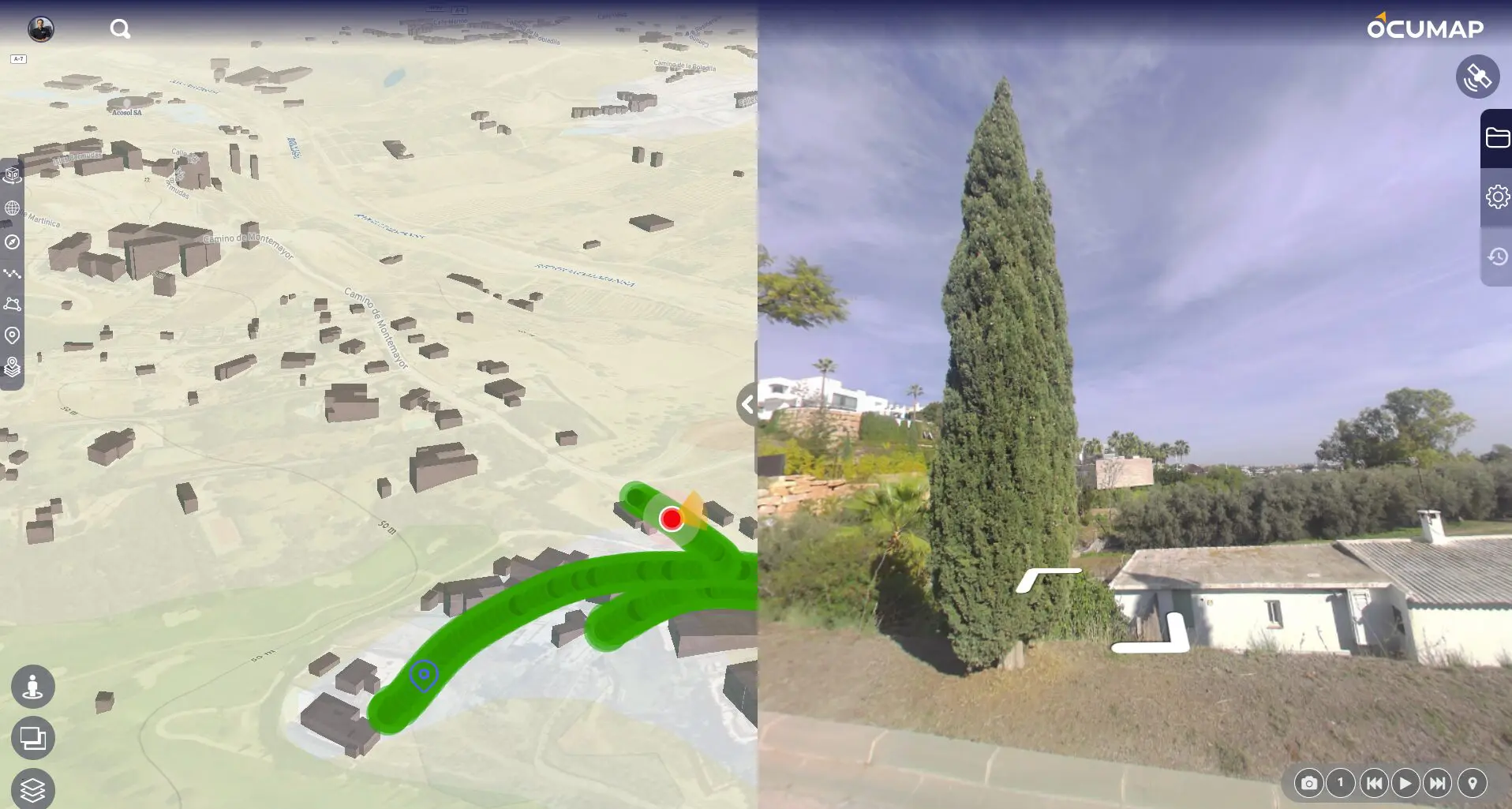
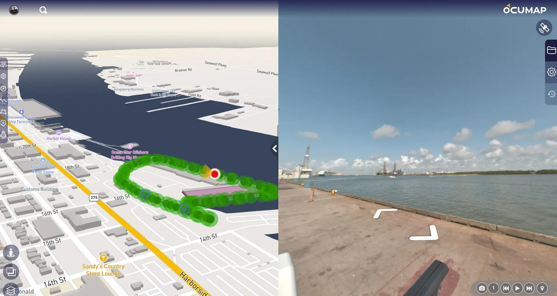
OcuMap is an innovative GPS mapping software designed to go where Google Street View cannot. This robust tool offers comprehensive environmental mapping solutions, enabling users to document wetlands, waterways, and land using GPS-based photos or videos. Whether walking, biking, or flying over the area of interest, OcuMap allows you to capture data once and make informed decisions from the comfort of your office.
Why Choose OcuMap for Environmental Mapping?
Environmental mapping requires precision, accuracy, and a user-friendly interface. OcuMap excels in all these areas by providing a seamless experience for environmental professionals. The software’s ability to tag points of interest directly from photos enhances decision-making processes by offering accurate GPS coordinates that can be easily shared with project stakeholders.
How Does OcuMap Enable GPS-Based Photo and Video Documentation?
OcuMap’s strength lies in its ability to use GPS-based photos and videos to document various environments. This feature is crucial for creating accurate visual maps that reflect real-world conditions. By walking, biking, or flying over the area of interest, users can capture comprehensive data sets that provide a clear understanding of the environment.
What Are the Key Features of OcuMap?
- Visual Mapping Software: OcuMap’s visual mapping capabilities allow for detailed environmental assessments. Users can publish maps privately or publicly, gaining better insights through easy-to-follow visual documentation.
- Tag Points of Interest: With OcuMap, you can tag points of interest directly from photos. This feature provides precise GPS coordinates that can be shared with stakeholders, enhancing decision-making processes.
- Control Over Data: OcuMap offers full control over your data, including how you want to publish it and who should access it. This flexibility ensures that your environmental assessments are both secure and effective.
How Can Environmental Professionals Benefit from Using OcuMap?
Environmental professionals can significantly benefit from OcuMap’s comprehensive mapping solutions. The software’s ability to document wetlands, waterways, and land using GPS-based photos and videos provides a clear and accurate representation of the environment. This data can be crucial for environmental assessments, planning, and decision-making.
How Does OcuMap Improve Decision Making for Environmental Projects?
OcuMap enhances decision-making by providing accurate GPS coordinates and visual documentation. By tagging points of interest directly from photos, users can quickly identify and share critical information with stakeholders. This feature streamlines the decision-making process, ensuring that all parties have access to the most accurate and up-to-date information.
What Are the Advantages of Using Visual Mapping Software for Environmental Assessments?
Visual mapping software like OcuMap offers several advantages for environmental assessments:
- Enhanced Accuracy: Visual maps provide a detailed representation of the environment, ensuring that assessments are accurate and comprehensive.
- Improved Communication: Visual documentation makes it easier to communicate findings to stakeholders, facilitating better decision-making.
- Flexibility: Users can publish maps privately or publicly, controlling who has access to the data.
How Does OcuMap Facilitate the Documentation of Wetlands, Waterways, and Land?
OcuMap simplifies the documentation process by using GPS-based photos and videos to create detailed visual maps. This feature is particularly useful for documenting wetlands, waterways, and land, as it provides a clear and accurate representation of the environment. Users can capture data once and make informed decisions later, streamlining the documentation process.
What Makes OcuMap Stand Out in the Market?
OcuMap stands out in the market due to its user-friendly interface, comprehensive features, and ability to provide accurate visual maps. The software’s capability to tag points of interest directly from photos and share GPS coordinates with stakeholders makes it an invaluable tool for environmental professionals.
How Can OcuMap Be Used for Environmental Planning and Management?
OcuMap can be used for various environmental planning and management tasks, including:
- Site Assessments: By documenting sites using GPS-based photos and videos, users can conduct thorough site assessments.
- Monitoring Changes: Visual maps allow for the monitoring of environmental changes over time, providing valuable data for planning and management.
- Stakeholder Communication: OcuMap’s ability to tag points of interest and share GPS coordinates facilitates clear and effective communication with stakeholders.
What Are the Future Prospects for OcuMap in Environmental Mapping?
The future prospects for OcuMap in environmental mapping are promising. As technology advances, the software is likely to incorporate even more sophisticated features, further enhancing its capabilities. Environmental professionals can look forward to continued improvements in accuracy, user-friendliness, and functionality.
How Can OcuMap’s Data Control Features Benefit Users?
OcuMap’s data control features provide users with the flexibility to publish maps privately or publicly. This control ensures that sensitive data remains secure while still allowing for effective communication and decision-making. Users can tailor their data sharing preferences to meet the specific needs of their projects.
Conclusion: Why OcuMap is the Ultimate Tool for Environmental Mapping
In conclusion, OcuMap offers a comprehensive and user-friendly solution for environmental mapping. Its ability to document wetlands, waterways, and land using GPS-based photos and videos provides environmental professionals with the accurate and detailed data they need for effective planning and decision-making. With features like tagging points of interest, visual mapping software, and full control over data publishing, OcuMap stands out as the ultimate tool for environmental mapping.
For more information and to experience the benefits of OcuMap, visit https://ocumap.com/utility-mapping/.