What is GIS and how is it used? GIS or geographic information system, is a technology used to capture, manage, and analyze data, specifically geographical data. Where data and location meet, that’s GIS. The data that GIS integrates is geospatial, meaning it relates to a position on the Earth’s surface.
The GIS technology is dynamic and a field that is only growing with time.
What does GIS do?
GIS has a variety of practical uses. Simply put, it makes it possible for you to efficiently utilize data tied to a location by using the science of geography.
With GIS, you can organize multiple learning layers into easy to understand visualizations as three-dimensional outputs and maps. This powerful function is particularly valuable since it reveals greater insights into the available data including relationships and patterns. Users are then able to make smarter, more informed decisions using those insights.
That is the ultimate goal of using GIS: extracting useful information from data sets. Data is only as valuable as the practical, relevant intel it provides and GIS helps ensure you get that intel from your data.
How is GIS used?
One of the functions of GIS is identifying problems. With well-mapped data, patterns based on geography become much clearer. You will find it even easier to analyze geographically-tied issues using GIS.
If detecting changes is your goal, GIS is an ideal tool to use. Through GIS, you can track the ways that an area or other point of interest changes over time. The visual data displayed with GIS is a much more efficient way of tracking change than spreadsheets and numerical calculation. The technology simply layers the submitted data collected at various points for easy comparison. Those in urban planning or construction may find this an especially useful function of GIS.
When looking to the future, GIS also helps with predictive analysis and allows users to conduct forecasting. The ability of GIS to highlight changes that have occurred over time works to forecast changes that will occur in the future. One application of this function could be forecasting traffic, for example.
How does GIS work?
GIS works by putting data into useful layers to make it more manageable and useful.
At any given point on Earth, there are things directly on the surface, below the surface, and above the surface. All of the data at a specific location may be relevant but it would be difficult or even impossible to capture simultaneously in an understandable way.
GIS makes displaying these data layers a breeze. You can examine each layer independently or view layers concurrently to gain insights into the relationships between them. It’s as simple as turning a layer on or off to change the visual representation.
The data managed through GIS can come in many common forms including photos, videos, and spreadsheets. However, vector and raster data are the two main types of geospatial data in GIS. Vector data is composed of paths and vertices. Raster data, on the other hand, consists of pixels (or grid cells, as they’re sometimes called).
GIS Mapping
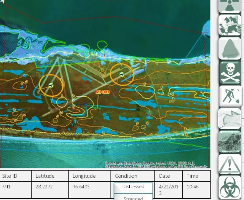
The most common application of GIS is map-making. GIS can handle massive amounts of complex data successfully which makes it the perfect choice for modern maps that often incorporate lots of information.
GIS is used for data pieces that are attached to geospatial points (a specific latitude and longitude), meaning mapping is often the most effective way to visualize the data. The maps are the geographic holders of the layers of data under analysis.
GIS maps are particularly useful because they are easy to embed in apps or otherwise share, making them very accessible.
GIS & Panoramic Video
When combined with a 360 degree video or a panoramic video, GIS users find it even easier to visualize their site of interest from any location. For example, if the user is trying to identify defects along the road network, a panoramic video provides the real-life view of existing road networks, enabling the GIS user to geotag or extract location directly from the video. Extracted points are then displayed on the map showing the exact location of the geotagged defect. Another use case for panoramic video GIS is to generate a digital asset inventory, cites need this information to maintain existing assets and improve mobility.