
Public Infrastructure Agencies have the burden of managing infrastructure assets such as roads, highways, sidewalks, traffic signs and signals in order to ensure the safety of the public. While this is a vital task for any thriving nation, it comes with many challenges due to the sheer size of the geographic area and the number of assets that must be managed.
The first step in managing infrastructure assets is locating these assets in a digital or GIS format. Conventional methods of locating assets involve personnel driving and/or walking these large geographic areas with a GIS collector or with pen, paper and handheld GPS device.
What to Consider for your Infrastructure Asset Inventory
While the process of locating assets is time consuming, expensive, labor intensive and could pose safety concern to the personnel involved (depending on the asset location), finding an easy and cost-effective way to benefiting from this data is another problem. Smaller size counties and cities do not necessarily have the large GIS infrastructure needed to handle such tasks, instead they rely on simple, but manual methods. For example, a small county or small city might have 20,000 traffic signs located along the roads, these signs must be documented, then assessed based on MUTCD code type and location, which means if conventional asset inventory methods were used, the person would be documenting (stopping the car) 20,000 times. Imagine having that in your Job description? Luckily, technology is here to help eliminate that tedious process.
How is OcuMap used to Safely Locate Infrastructure Assets?
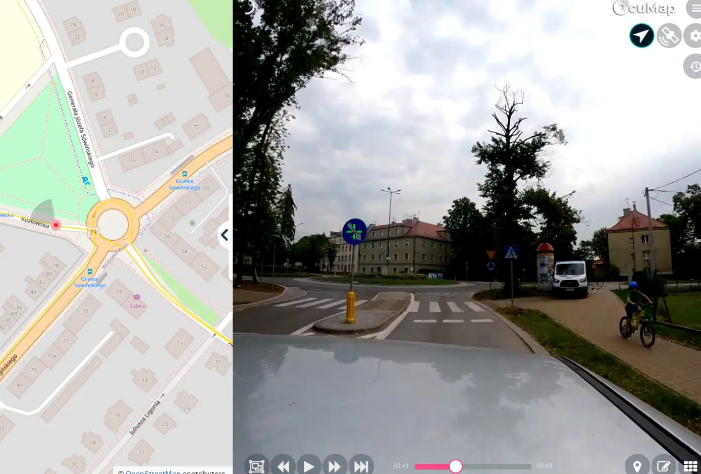
Using any GPS-based camera, you can mount the camera on your car and drive the area of interest while recording video or images. Once you are back at the office, you can upload your gps videos or images to your OcuMap account and will immediately be able to view your geo-referenced images and videos on the map. Grab a cup of coffee, click the play button and start watching your GPS videos from your desktop, once you see an asset within the right of way that needs to be documented, click the Plus icon, type the name of the asset, click save and you are done. Repeat as needed. Once you finish watching your video, you can access all of the geotagged POI (assets) directly from the map or export them into a CSV file that can be handed over your GIS team.
What Type of Infrastructure Assets Can I Map?
Street Signs, Curb inlets, sidewalk (pavement), trees, potholes, manholes, or whatever you can see in your GPS video. All point features can be extracted (geotagged) directly form GPS images and video. OcuMap supports GIS using WFS/WMS where you can bring your layers onto the basemap to help you manage your attributes for the newly geotagged points. Using this new method will increase your infrastructure asset inventory by 60% and reduce cost by at least 30%. In addition, you can ensure that your employees are safe when they go out and collect the data. Should you need help collecting data, feel free to reach out to us, we’d be happy to assist you with Infrastructure asset mapping and inventory.
How Accurate would my Infrastructure Assets be using OcuMap?
Accuracy depends on mainly on the GPS receiver used however, most off-the shelf GPS cameras now have about +- 1 m (3 ft) accuracy. This is considered adequate based on asset location industry standard, however, if you require more accurate spatial location, you may want to look into industrial-grade mapping systems such as Flir-Ladybug system and NC tech iStar camera system, or even use a DSLR with a PC-based RTK GPS receiver. One useful feature in OcuMap allows you to edit your geotagged point of interest directly from the map, for example, let’s say you geotagged a traffic sign form the video, the sign is shown to be 3 meters (10 feet) away from what the basemap shows, you can always grab the geotagged pin from the map, drag and drop it where you think it should be and OcuMap will grab the Latitude, Longitude of the new location to update the position of the POI.