Mapping is essential for your projects. But infrastructure assessment, and asset inventory build can require expensive and time-consuming efforts such as multiple site visits, back and forth communication with the field and office, photos, messages, etc. Alternatively, you can try to rely on geographic information system experts with expensive hardware—who may know their work very well but will take longer to document your project assets.
OcuMap is the SaaS-based solution that brings your worksite onto your team’s desktop. Efficient, user-friendly, and built to adapt to the specific needs of any project.
The result: better decisions, reduced cost, and faster condition assessments that give you the ratings you need up to ten times faster.
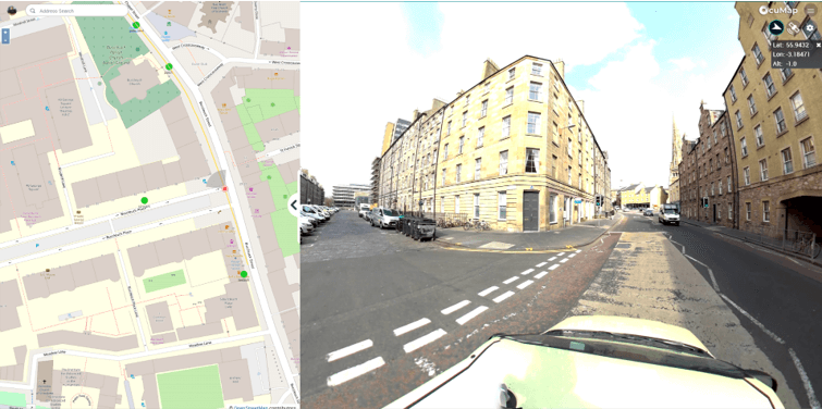
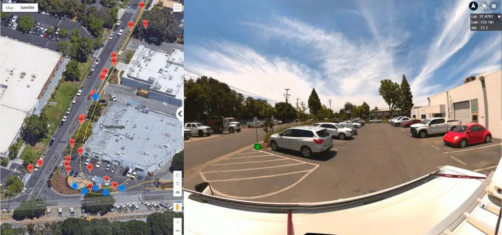
OCUMAP IN ACTION – MAPPING
OcuMap allows you to maximize the time and the information from any site visit. You and your team can use any camera that has GPS capability—including smartphones, drones, 360 cameras, DSLRs, action cams, and many other inexpensive off-the-shelf products. You’ll no longer have to rely on LIDAR (light detection and ranging) to extract features of interest or locate defects.
This ease and speed allow you to reduce site visits while fully directing image capture and information. You control the creation of relevant site maps that surface the information that is most essential to your project.
Our clients have utilized OcuMap on a range of projects and have discovered the ease and value on:
Railway Mapping: OcuMap allows clients to bring the entire track onto desktops, where they can be revisited as often as needed without additional visits. By generating a complete asset inventory in just one run, clients improved track inspection efficiency by forty percent.
Road & Highway Mapping with OcuMap reduced clients’ asset inventory costs by as much as thirty percent. The video log feature allows your team to build asset inventory with any GPS-enabled camera, all while traveling at driving speed.
Clients working in Environmental Fields need real-time mapping that geographical information systems often can’t provide. Restoration and mitigation plans need up-to-the-minute visual data; the constantly shifting landscapes, both coastal and inland, require more than most GIS systems provide. OcuMap expands on the information in ways that can make an immediate difference in environmental plans.
No matter what type of project you and your team are working on: once the site visit is over, you will see how the power of OcuMap becomes exponential when you bring it into your virtual workflow.
OCUMAP IN ACTION – YOUR DIGITAL WORKFLOW
When you upload your collected and geotagged imagery and videos, the OcuMap’s user-friendly interface goes to work. The dashboard seamlessly integrates with your geographic information system, via Web Mapping Services (including Tiled Service), so that your data is synchronized within a single dashboard.
Every image you upload can contain any information you need to surface. You can bring relevant websites and documents to the foreground with one click. OcuMap heightens and streamlines communication by linking time-stamped comments from your team to each point of interest.
All stakeholders who need access to the information will have an intuitive dashboard to stay on top of the project. You can publish projects privately or publicly, complete with 360-degree videos and panoramic imagery. OcuMap also understands the language your teams speak, allowing you to bring your keyhole markup language online.
The result: the physical worksite becomes a virtual workspace without additional visits or costly miscommunications. Overall inspection efficiency almost doubles. Real-time commenting, the ability to assign geo-located tasks, stakeholder feedback—it all exists in a virtual field that encompasses all the information that you need when you need it.
The GIS revolution changed site mapping; OcuMap is the next and most powerful step.