Interactive mapping software is a powerful tool that allows users to create, visualize, and analyze data on a map. It is used in a variety of industries, including business, government, and education.
In this article, we will explore the best interactive mapping software available in 2024. We will discuss the features and benefits of each software, as well as its pricing and support options.
1. OcuMap
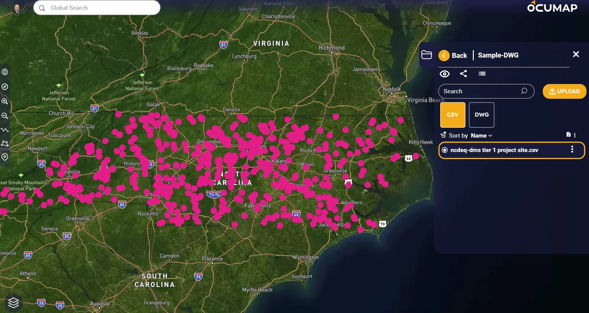
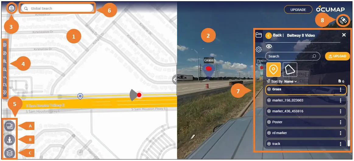
Ocumap is an innovative interactive mapping software that combines Reality Capture, GIS and BIM to better manage your assets, optimize operations, and make more informed decisions.
Features:
Simply drag and drop your GPS photos to see them on the map
- Inspect and plan infrastructure maintenance from your desktop
- Generate asset inventories directly from your street photos
- Extract gps coordinates from photos
- 3D Visualization capabilities
- DWG viewer, Revit viewer
- Video on the map
- KMZ/KML visualization
Pricing:
- Free Trial
Support:
- Live Support
- Online Demo Set Up
- Online documentation
2. Tableau
Tableau is a leading interactive mapping software that is used by businesses of all sizes. It is known for its ease of use and powerful data visualization capabilities.
Features:
- Drag-and-drop interface
- Wide variety of chart and map types
- Real-time data updates
- Mobile app
- Collaboration features
Pricing:
- Personal: Free
- Professional: $35/user/month
- Team: $70/user/month
- Enterprise: Contact for pricing
Support:
- Online documentation
- Community forum
- Paid support
3. QGIS
QGIS is a free and open-source interactive mapping software. It is a powerful tool that is used by professionals in a variety of industries.
Features:
- Cross-platform support
- Wide variety of data formats supported
- Advanced geospatial analysis tools
- Plugin architecture
- Customization options
Pricing:
- Free
Support:
- Online documentation
- Community forum
- Paid support
Esri ArcGIS
Esri ArcGIS is a commercial interactive mapping software that is used by businesses, government agencies, and educational institutions. It is a powerful tool with a wide range of features.
Features:
- Comprehensive set of mapping and analysis tools
- 3D visualization capabilities
- Mobile app
- Collaboration features
- Enterprise support
Pricing:
- Contact for pricing
Support:
- Online documentation
- Community forum
- Paid support
Mapbox
Mapbox is a cloud-based interactive mapping software that is used by businesses of all sizes. It is known for its beautiful maps and ease of use.
Features:
- Drag-and-drop interface
- Wide variety of map styles
- Real-time data updates
- Mobile app
- Collaboration features
Pricing:
- Free plan available
- Paid plans start at $50/month
Support:
- Online documentation
- Community forum
- Paid support
Google Maps Platform
Google Maps Platform is a suite of mapping services that includes interactive mapping software. It is a popular choice for businesses that want to add maps to their websites or mobile apps.
Features:
- Drag-and-drop interface
- Wide variety of map types
- Real-time traffic data
- Street View
- Business listings
Pricing:
- Free plan available
- Paid plans start at $200/month
Support:
- Online documentation
- Community forum
- Paid support
There are many different interactive mapping software options available, so it is important to choose the one that is right for your needs. Consider the factors such as features, pricing, support, and ease of use.
With the right interactive mapping software, you can create beautiful and informative maps that can help you visualize and analyze your data.