Enter OcuMap 3D Mapping Softwares, a cutting-edge solution poised to revolutionize the art of image-based mapping. This software, a result of relentless innovation in the field, transcends traditional mapping boundaries to offer a sophisticated and user-friendly approach to mapping infrastructure assets using GPS based imagery and videos that can be collected with a plethora of cameras.
Unveiling OcuMap 3D Mapping Software
This 3D mapping softwares is designed to simplify and democratize the street mapping process. It serves as a comprehensive solution for urban planners, GIS professionals, and government agencies seeking simple and reliable geotagging tool for GPS photos and videos. It uses commonly used formats such as mp4, gpx, jpeg and csv to locate your videos and photos on the map.
Key Features:
1. Visual Inspection from your desktop:
Collect your GPS videos and photos using any camera, upload them to OcuMap and start performing visual inspections directly from your desktop. You can simply annotate features inside the photos and the software will geotag these annotations for you with latitude and longitude.
Designed with the end-user in mind, OcuMap boasts an intuitive interface that caters to both seasoned GIS professionals and Project Managers. The software’s user-friendly features streamline the mapping process, reducing the learning curve and increasing overall productivity of the entire organization.
2. Securely share your project with your team:
Unlike other street mapping tools, your data is private in OcuMap, you have full control over who and when to share your street level data with. When you decide that you are done with the project, you can simply delete it. Help your team make better and more informed decisions by simply inviting them to view the project details.
3. No Processing time:
You can simply upload your GPS based photos of GPS videos to the map and see them instantaneously without any wait time. Whether it’s urban planning, infrastructure development, or environmental assessment, OcuMap will show you the location of your photos and the map and you can immediately start geotagging points of interest.
Applications Across Industries
1. Urban Planning and Development
OcuMap helps urban planners visualize their data on the map and compare historical imagery to new ones to see what changed. Note. OcuMap does not provide map data, instead, it relies on the data you collect to properly display it on the map and keep it private. In addition to GPS based imagery, City Planners can upload 3D city models in different formats including gltf, fbx, revit, etc. and plan the next steps for zoning, or urban renewal projects.
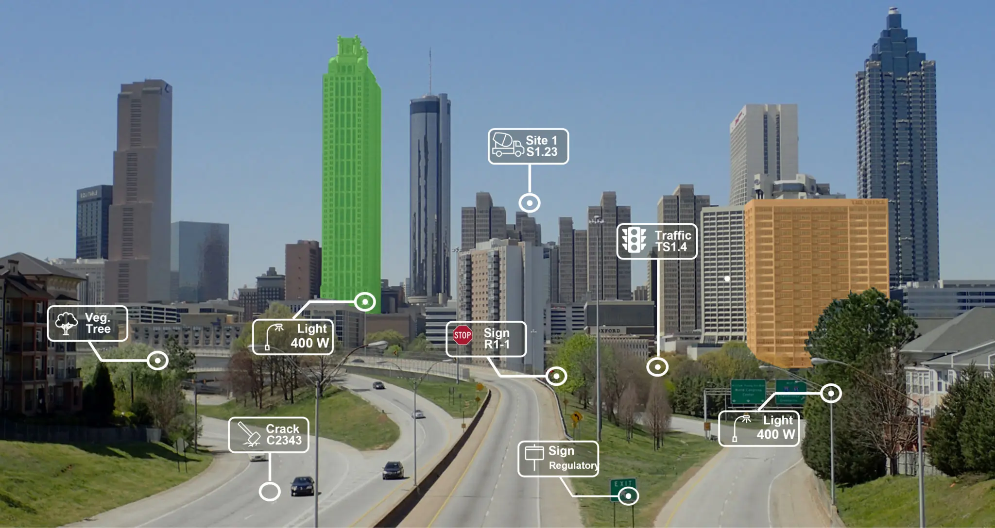
2. Utilities and Smart City Mapping
If you are trying to locate your assets straight from imagery, then OcuMap is the easiest way to do that. You can upload KMZ/KML files to start your mapping process, then once you collect your route videos, you can upload them and start verifying location of assets and or add new ones. Once you’re done, you will get a holistic view of how your assets are spread out around the city and where you can add more sensors for implementing your smart city initiative.
3. Environmental Mapping
Go where google streetview did not go and collect your own 360 imagery of wetlands and streams, then perform your assessment from your office working with subject matter experts online.
From user-friendly, precise mapping to 3D data integration, this software is poised to revolutionize the way we perceive and plan our urban environments. Embrace the future of image-based mapping with OcuMap, and witness the transformation of your mapping endeavors into seamless, efficient processes.