GPS Video Software for
Street Mapping with a GPS Camera
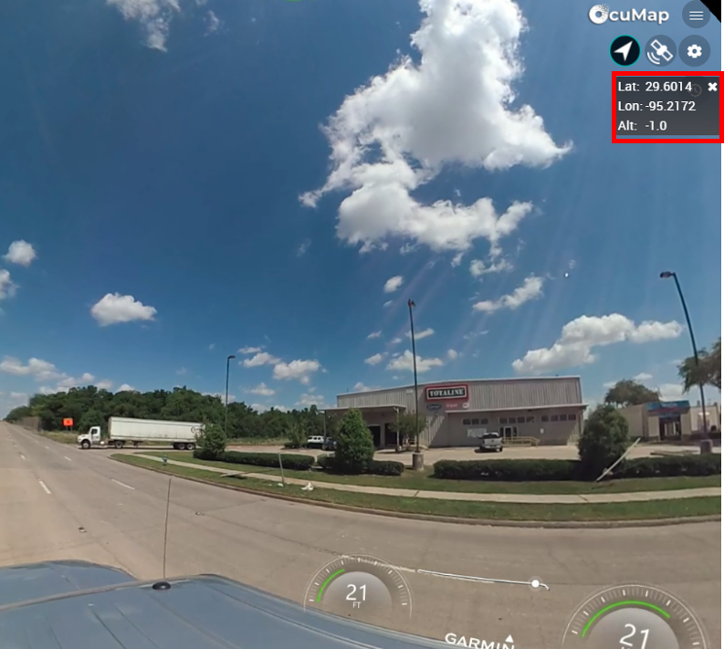
OcuMap brings all your GPS videos under a single dashboard where you can view their location on the map, geotag a point of interest, and generate a database directly from your videos. You can collect your GPS videos using any camera, upload them to OcuMap and you’ll be in business.
Video Log
Easy to use video log with a map
Do you need to quickly locate your street assets with ease? OcuMap is the ideal solution for Rapid City mapping that can help you locate areas of interest visually and with GPS coordinates directly from your desktop. You can collect GPS videos for streets, highways, railroads, water streams, off-road tracks, etc. and upload them to your OcuMap account. Data is processed in Real-Time and can be accessed as soon as you are done uploading.
Right of Way & Corridor Mapping
Video based mapping solution for Smart Cities
Ideal Solution for Infrastructure Asset Mapping
Urban Planning | Condition Assessment | Smart Cities
OcuMap can help you perform Rapid Infrastructure condition assessment using predefined criteria set by you. It combines GIS layers, GPS videos, Basemaps and GPS imagery into a centrally located platform to streamline asset data visualization and feature extraction based on location.
Walkability Studies within Days
Locate ADA ramps through out the city within days using GPS Video
Drive it once, Revisit it as many times as you need to, from anywhere on any device.
Safely document road conditions before, during and after construction. Get a digital footprint of your project site at any moment in time without disrupting operations or traffic. Any site personnel with a GPS video camera can send you visual status updates within minutes
Railroad GPS Video Mapping
With limited track time, GPS video can help you document hundreds of miles in one run, bring all the data onto your desktop, inspect and locate defects within hours.

Get your Aerial GPS Videos on the Map
Mobile Mapping with GPS Video
Street Level Video Survey
Street Asset Mapping
Traffic Sign Inventory
Condition Assessment
Smart City Mapping
Walkability Studies
Aerial GPS Video Surveys
Guardrail Assessment
Corridor/ ROW Mapping
GPS Video Log
PTC Asset Location
Railroad Video Map
GPS Video FAQ
GPS Video mapping has become more affordable in recent years. While there are many questions about how it works, it’s benefit , data format, how its is collected, we tried to cover the most frequently asked questions below. If you have more questions you would like us to answer, please contact us, we’d be happy to help you.
What is GPS Video and what is it used for?
 A: GPS Video is a video file associated with geospatial location.
 A: GPS Video is a video file associated with geospatial location.
GPS video is a type of video where the camera records GPS location from satellite using a built-in GPS receiver inside the camera or by other means such as attaching a GPS receiver and synchronizing it with camera triggers based on UTC or GPS time. Each frame of the video is typically connected to a position on earth (Latitude, Longitude). When this data is combined together into a single file or two separate but related files, it allows us to locate where this video was taken on the map.
GPS Video is used to simply show the location of a video on the map or to communicate the lat, long of that video on the surface of earth. This has many use cases specifically in mapping application, city mapping, environmental mapping, military, maritime, etc.
What camera can I use for GPS Video?
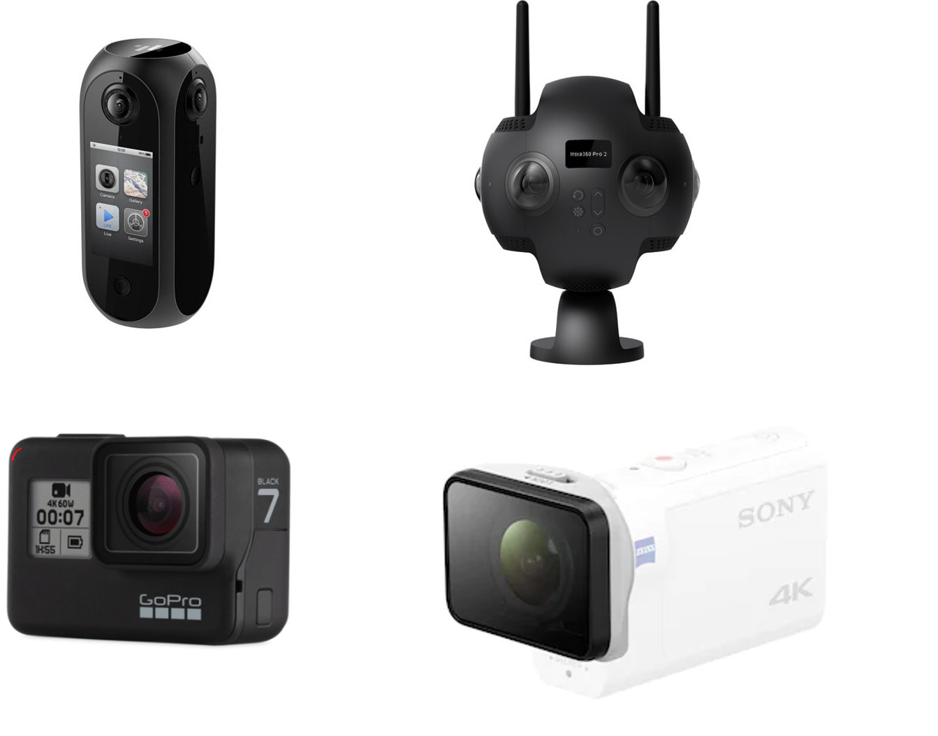
A: There are many off-the shelf GPS Cameras that can be used depending on your application
- For 360 GPS video camera, we recommend the Insta 360 Pro 2, and the Pilot ERA
- For regular GPS video camera, we recommend the GoPro Hero Black and the Sony FDR-X3000
What files can I upload to OcuMap to view my GPS Video?
A: Mp4 with Embedded GPS or MP4 with XML, GPX, SRT, TXT, CSV, or Parse your own.
If you chose to parse your own GPS file, you will need to upload an Mp4, then copy and paste the GPS lat, long, alt and time into the OcuMap GPS parser. For more info in how to parse your Video GPS file, check out our knowledge base here
Can I geotag a Point of Interest from my Video GPS?
A: Yes, with OcuMap’s hotspot function, you can geotag any POI inside the video and the software will estimate the GPS location directly on the map.
Geotagged POI can also be exported as a CSV file for further GIS analysis. For more info on Geotagging a Video GPS file, please visit our knowledge base here