Mobile Mapping Software

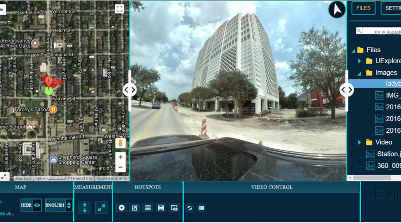
OcuMap for Mobile Mapping-Street Level Imaging

User-Friendly Mobile Mapping Software OcuMap offers users of street level imagery a comprehensive video data management software solution, enabling them to speed up data management workflows and share their data inside their organization. Over the years, street level imagery has...

drone data management software

Drone Mapping | Too Much UAV Data To Manage?

Drone Data Management Software Might Help! There was a time when the usage of drones was only limited to the military. However, the usage and applications of commercial drones are on the rise today and drones industry is growing faster...