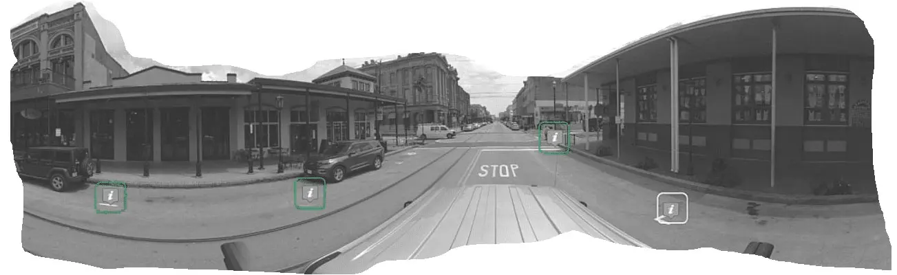
Street Mapping
Infrastructure quality assessment, documentation and maintenance support,
Perform Land and property value assessment for taxation
Review and assessment of signage, signals and wayfinding guides
I am text block. Click edit button to change this text. Lorem ipsum dolor sit amet, consectetur adipiscing elit. Ut elit tellus, luctus nec ullamcorper mattis, pulvinar dapibus leo.
I am text block. Click edit button to change this text. Lorem ipsum dolor sit amet, consectetur adipiscing elit. Ut elit tellus, luctus nec ullamcorper mattis, pulvinar dapibus leo.
Pedestrian walkway infrastructure assessment and ADA compliance
Railroad Mapping
- Right of Way Assessment
- PTC Signal Mapping
- Visual Track Inspection
- Maintenance Monitoring
- Emergency Response
Do More and Achieve More
OcuMap is an innovative mapping software that combines Reality Capture, GIS and BIM to better manage your assets, optimize operations, and make more informed decisions.
Street Level Mapping
County Appraisals
Perform Land and property value assessment for taxation
Public Works
Infrastructure quality assessment, documentation and maintenance support,
Public Safety
Emergency response and planning for public safety and law enforcement
Transportation Safety & Traffic Control
Review and assessment of signage, signals and wayfinding guides
Pavement Condition Assessment
Walkability Studies
Pedestrian walkway infrastructure assessment and ADA compliance