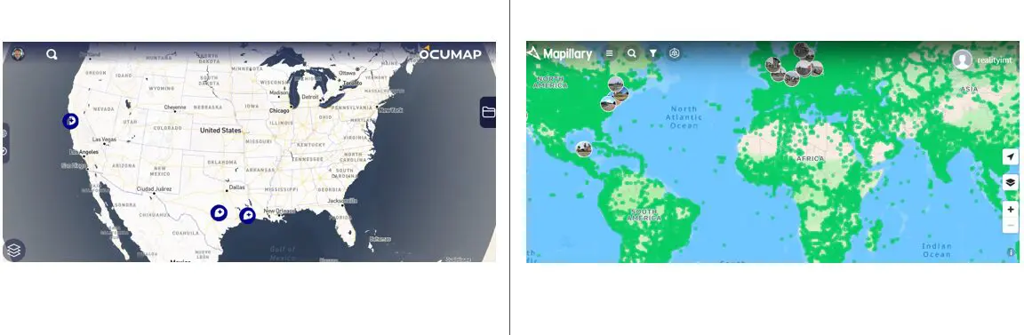

If you are searching for a Mapillary alternative, the first question is not which platform has more features. It is whether you want to contribute imagery to a shared street-level map or maintain a private visual documentation system for your own buildings, facilities and infrastructure.
Mapillary and OcuMap overlap around location-based imagery, but their core purposes are different.
What Mapillary is designed to do
Mapillary is a collaborative street-level imagery platform. Its official documentation describes workflows for uploading GPS- and timestamp-based imagery from mobile devices, action cameras and 360 cameras. Mapillary groups imagery into sequences and uses computer vision to process imagery and generate map features.
Mapillary also states in its licensing documentation that contributed imagery is shared under a CC BY-SA license while contributors retain ownership of their images. Its privacy documentation explains that uploaded imagery is automatically processed to blur faces and license plates.
What OcuMap is designed to do
OcuMap is a visual documentation platform for organizations that need to keep project and asset records under their own control. Instead of building a shared global street-imagery map, OcuMap organizes your documentation around the buildings, sites and infrastructure you manage.
- Private organization and project workspaces
- Photos, PNG/JPG, 360 imagery and MP4 video
- Native LAS, LAZ and E57 point-cloud viewing and measurement
- Calibrated in-photo length and area measurements
- PDFs and design references including DWG, RVT, FBX, OBJ and GLB
- Historical side-by-side comparison by location and date
- Curated Published Viewers for clients and stakeholders
- Original-file preservation and hardware-agnostic capture
Mapillary vs. OcuMap: the practical difference
| Need | Mapillary | OcuMap |
|---|---|---|
| Contribute street-level imagery to a shared map | Strong fit | Not the primary use case |
| Computer-vision map feature extraction | Core capability | Not a current core capability |
| Private project documentation | Different model | Core capability |
| Building floor-plan context | Not the primary workflow | Supported |
| Point-cloud viewing and measurement | Not the primary user workflow | Native LAS/LAZ/E57 support |
| Historical project comparison | Street imagery is time-based | Project-controlled side-by-side comparison |
| Client-facing read-only delivery | Public/shared imagery model | Published Viewer |
Choose Mapillary when
- You want to contribute to or consume a broad shared street-level imagery network
- Crowdsourced coverage and computer-vision map features are central to the workflow
- Your use case aligns with Mapillary’s public/shared contribution model
Choose OcuMap when
- Your organization needs to keep project documentation private and controlled
- You need more than street imagery: point clouds, floor plans, drawings, PDFs and building records
- You need in-photo or point-cloud measurement
- You need historical comparison as part of an asset record
- You need a read-only client delivery experience rather than exposing the internal workspace
They can also complement each other
An organization may use public street imagery for general context while maintaining project-specific documentation in OcuMap. The platforms solve different problems, so replacing one with the other only makes sense when your primary workflow matches the alternative.
What to test before switching
Use your own data. Upload a representative project, confirm how your imagery and GPS data are organized, test measurements and historical comparison, and publish a viewer for a stakeholder. That will tell you more than a feature checklist.
Try OcuMap as a private visual documentation alternative →
Practical checklist
- List the workflow requirements before comparing feature lists.
- Test with your own imagery and data volumes.
- Confirm privacy and licensing expectations.
- Check whether the platform supports your non-imagery files.
- Evaluate long-term export and original-file ownership.
- Test the external sharing experience with a real stakeholder.
Related resources
Common questions
Is OcuMap a drop-in replacement for Mapillary?
Not for every workflow. Mapillary is built around a shared street-imagery ecosystem and computer-vision map data. OcuMap is built around private project and asset documentation.
Does OcuMap contribute my imagery to a public map?
No. Your organization controls the project. Content is shared externally only when you intentionally publish or otherwise grant access.
Can OcuMap handle more than street imagery?
Yes. It supports building documentation, floor-plan context, point clouds, design references, PDFs, historical comparison and client-facing Published Viewers.